WHAT IS THE COMPREHENSIVE PLAN? The Comprehensive Plan is the overarching planning document that outlines goals for the next decade of growth in the City of Charleston. The plan guides local decision makers in managing change in our city, including
What’s the Latest? In October 2022, Hilton Head Town Council and Beaufort County agreed to proceed with the U.S. 278 corridor project. The agreement paves the way for an environmental assessment from federal and state agencies to take place. It
Update: In April 2019, as a result of large-scale community opposition to the proposed development, the Town of Moncks Corner Planning Commission voted 4 to 2 to recommend denial to annex Gippy Plantation into the town and rezone the property
Since 2002, Beaufort County voters have supported the Rural and Critical Lands Program to protect land. Today, over 24,000 acres are protected. The Rural and Critical Lands program began in 2002 and levies your property taxes to protect land. This
Recently denied Hardeeville annexation and future development What is annexation? Annexation is the legal process used by municipalities to expand their borders, bringing additional land under the municipality’s governance. Annexations have been used to grow the populations of urban centers
The 23,828 acre Ashley River Historic District corridor, listed on the National Register of Historic Places, represents more than 300 years of cultural and ecological significance for its association with the Lowcountry’s inland and tidal rice cultivation history, the Civil
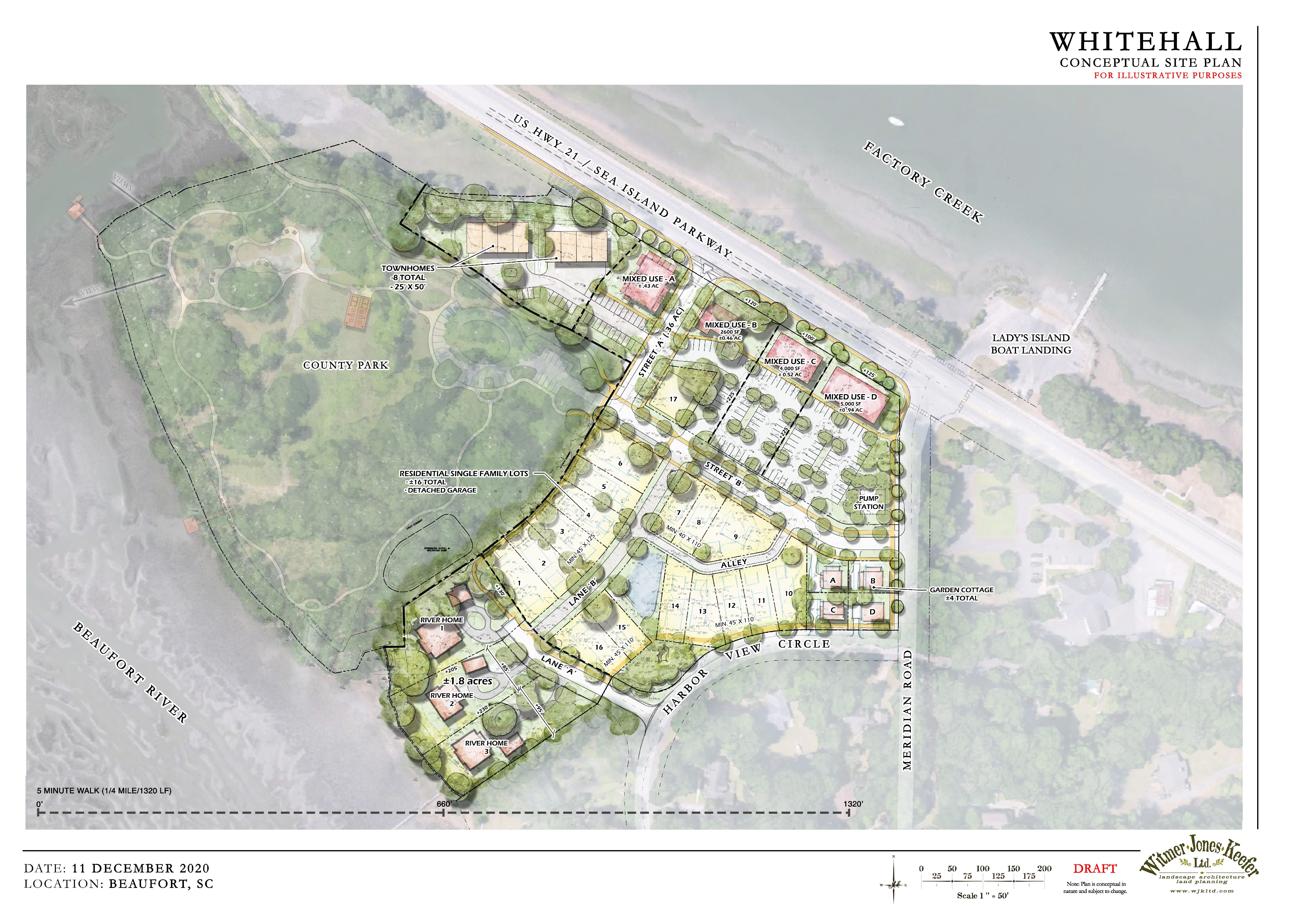
Image from the Beaufort Civic Master Plan, adopted 2014. Whitehall is a logical growth area for the City. Whitehall’s location, along the water and close to downtown, is well suited for growth, but past development proposals for this property have
In December 2016, a pedestrian was struck by a car and killed in a hit-and-run accident while attempting to cross the intersection at Coming Street and Septima P. Clark Parkway. Sadly, this tragic incident marked the third pedestrian fatality at
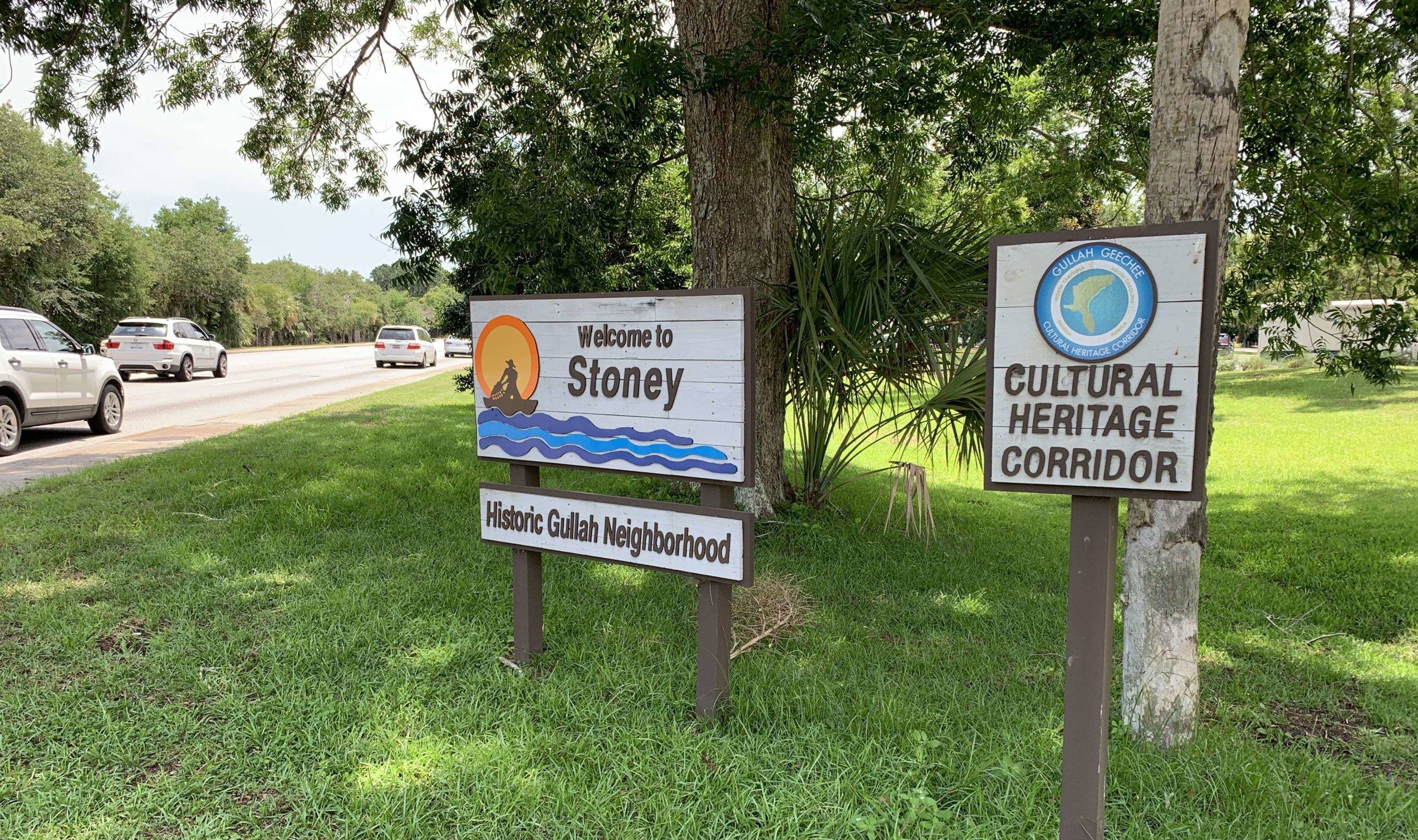
Lady’s island is a beautiful 13,000-acre island experiencing rapid growth. It could be a connected community where residents can live, work and play. To accomplish this, we believe future development should be compact and include a mix of land uses,
Local: The mossy grand oaks shading Maybank Highway frame the iconic gateway to Johns Island – and they need to be saved. An alternative design for the Maybank Highway widening project with 11-foot lanes and an off-road multiuse path would
Charleston County voters passed a referendum on November 8th, 2016 for a half-cent sales tax increase to fund road projects, mass transit, and the greenbelt program. The referendum puts the local sales tax rate at 9% — higher than the
About the Project: The intersection of US 17 and Main Road is notoriously plagued by problems. Every day at rush hour the intersection gets snarled in traffic as drivers try to turn left onto Johns Island. This intersection is also