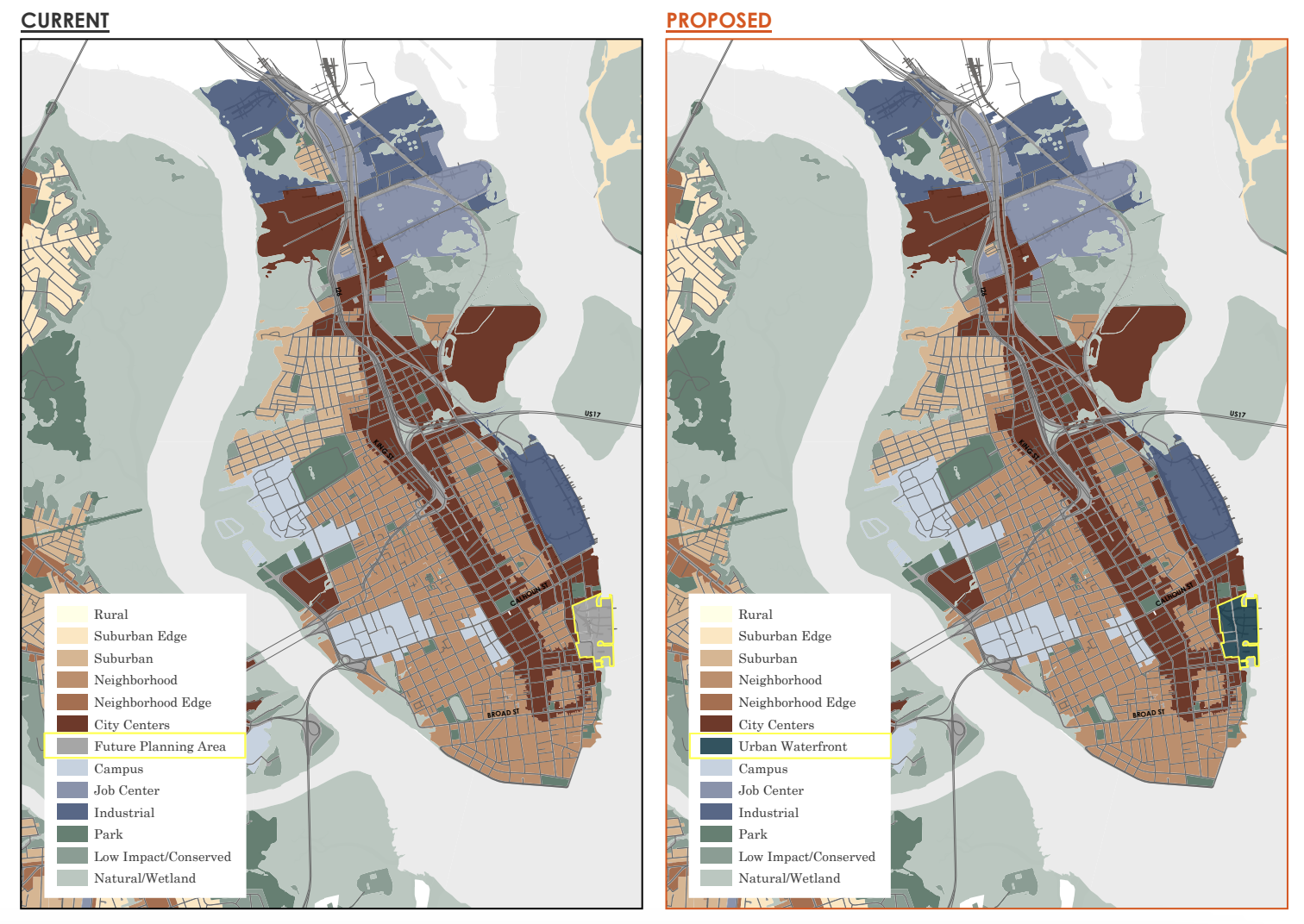
Future Land Use Map Amendment / City of Charleston
The City of Charleston defines resilience as “the capacity of a community, business or natural system to prevent, withstand, respond to, and recover from a disruption.” Most often, when we think about resiliency in the greater Charleston region, we think about our ability to absorb and recover from impacts related to flooding, storm surge, rain bombs, or hurricanes. Examples of resiliency measures can include green infrastructure like living shorelines or bioswales, floodable spaces, low-impact development techniques, permeable pavers, upgraded stormwater infrastructure, or elevation-based zoning.
Check out the City of Boston’s new resilient urban waterfront, Moakley Park, for an example of what we know is possible at Union Pier. In addition to advocating for resiliency, we are advocating for ample open space, public access, connectivity, and for areas beyond the critical line to remain building-free and in the public trust. We will continue to provide input and comments as the project moves through the Council process, and plan to work closely with the developer to communicate our vision for the site.
If you want to join in our efforts to advocate for resiliency at Union Pier, the Urban Waterfront District description will have a public hearing and first reading at Charleston City Council on March 25th at 5:00 PM.